
- Home
- Canoe & Kayak Routes of Northwest Oregon
Canoe & Kayak Routes of Northwest Oregon: Including Southwest Washington
by Phil Jones
Updates & Corrections:
The third edition of Canoe & Kayak Routes of Northwest Oregon was released in February 2007.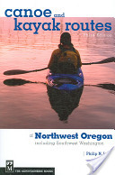
If you are looking for updates or corrections to the third edition, please see the updates and corrections listed below. For future updates and corrections, please visit this page from time to time. If you have updates or corrections to offer regarding the third edition, or any of the prior editions, please post them on the OOPS listserv or email them to me directly at philipnjones@yahoo.com.
For legal reasons, I feel compelled to include the following disclaimer: I do not guarantee that every possible update or correction will be available on this page. I disclaim any representation that this page is a complete or accurate list of updates and/or corrections. The reader uses this page, and any of my books, at their own risk.
I look forward to hearing from any of you who have corrections, updates, or other comments. I am very grateful for any suggestions you might offer.
- Phil Jones
(Last Updated: 9/2/2011)
Page 64 - Trip 9: Willamette River, Wheatland to St. Paul. The east channel behind Candiani Bar (RM 59) was reported to be blocked by a strainer in January 2007.
Page 85 - Trip 17: Calapooia River. The Calaoooia is reported to be blocked in early 2007 by a large log about 4 miles below the put-in. Very difficult to get around, moderately difficult to get over.
Page 100 - Trip 23: Tualatin River - Fields Bridge. The west end of Dollar Road has been disconnected from Willamette Falls Drive. To reach the launch, drive west on Dollar Road from downtown Willamette and park near the dead-end of Dollar Road.
Page 104 - Trip 25: River Mill Lake. The new boat ramp is in place and is open in Milo McIver State Park. (The campground closes in the winter, but the park stays open year-round.) Although the park charges $5 to enter, using the ramp is far superior to using the dock near Estacada that is described in the book. To reach the boat ramp after entering the park, go straight through two stop signs, then continue for a couple of miles (it's a big park). Look for a right turn marked by a sign pointing to Estacada Lake (the other name of River Mill Lake). Turn right, continue through a gravel parking area, and look for a road continuing on to the lake and the boat ramp. The park has two other boat ramps (known as Upper Ramp and Lower Ramp) but they are both located below the dam on the free-flowing river, not on the lake. Do not confuse them with the ramp on the lake.
Page 118 - Trip 31: Hosmer Lake. Paddlers are now not allowed to stop at the two islands in the northern pool of Hosmer Lake. Previously paddlers could visit the islands, but not camp. Now the islands are entirely closed, due to damage caused by visitors.
Page 133 - Trip 37: Lacamas Lake and Round Lake. In the fall, the level of these two lakes is reduced so that maintenance work can be done on the two dams. The water level is usually lowered in September or October, and then the lake refills within a month or two. Paddlers will want to avoid the lakes during that time period.
Page 139 - Trip 39: Salmon Creek. The best access to Salmon Creek at Felida Bridge is now on the southwest side of the bridge.
Page 222 - Trip 72: Siletz River - Strome Park to Pikes Camp. A new public park and boat ramp have been built at Rivermile 6.7. The name of the park is Ichwhit (Bear) Park.